
Collect all 11 maps from notice boards and fire escape plans. Your first Silver Pines map is on the roadside bulletin board in Outskirts, just after you collect the items from your car outside the Miner Diner. Later pickups include building evacuation plans, so check wall notices as well as outdoor boards.
Where are all the maps in Silver Pines?
The 11 maps cover Outskirts, Crimson Bear Motel, Downtown, Riverside, the Sheriff Station, Union Apartments, Sewers, Town Hall, Church Hill, Mount Siah Kopa, and Thelend Broadcasting Lot.
Some pickups look like ordinary safety notices. Inside buildings, a Fire Escape Plan is the map you're looking for. Match the location and the wall landmark below before moving on.
| Map | Where to collect it | Landmark or requirement |
|---|---|---|
| Outskirts | Roadside Silver Pines notice board, down and right from the starting diner. | Collect your car items first; look for the Outskirts sheet on the board. |
| Crimson Bear Motel | Outside the Museum and Gift Shop, to the left after the motel gate. | Unlock the gate first; the map is on the shop exterior. |
| Downtown | Bus stop just to the right of Loomis Park, after your first ferry arrival. | Head inland from the ferry and look at the bus stop. |
| Riverside | Cross the bridge, walk up toward the payphone, then take the stairs on the left. | The map hangs on the notice board. |
| Sheriff Station | Inside the station, in the hallway between the North Hall and Locker Room. | Unlock the station first; find the Fire Escape Plan above the couch. Continue with silver pines sheriff's office for this area. |
| Union Apartments | Wall near the front entrance, on your right as you enter. | Collect the Fire Escape Plan; the building is also called the Union Building. Follow silver pines union apartments for the building route. |
| Sewers | On the wall just inside the sewer entrance. | Get the crowbar before entering. |
| Town Hall | Enter Town Hall in the park and go upstairs; check the notice board to the right of the stairs. | Look for the Fire Escape Plan. Continue through the connected areas with silver pines town hall. |
| Church Hill | Inside the small Parish Hall building, behind a padlocked door. | Head into Parish Hall after arriving in Church Hill; use silver pines church hill for the area route. |
| Mount Siah Kopa | Just inside the tunnel farther east, on the right. | Reach the eastern tunnel after arriving on the mountain. |
| Thelend Broadcasting Lot | To the right near a door when you reach the Bleachers. | Complete the audio puzzle before reaching this pickup. |
Where do you get the first Silver Pines game map?
You get the first map from the Outskirts bulletin board after checking your car outside the Miner Diner.
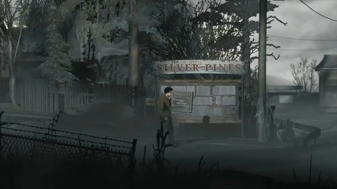
- Leave the Miner Diner and collect the items from your car.
- Move toward the foreground to load the next screen, then head right. You're looking for the large Silver Pines bulletin board beside the road.
- Take the map from the board. The screenshot shows the Outskirts sheet beneath the Silver Pines sign, which identifies the correct pickup.
Grab this before continuing toward the motel so you have the area's layout while exploring. The opening route continues in silver pines motel.
Where is the Crimson Bear Motel map?
The Crimson Bear Motel map is on the exterior of the Museum and Gift Shop, left of the unlocked motel gate.
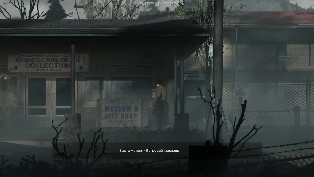
Unlock the gate, go through, and turn left toward the gift shop. Check the exterior wall rather than heading straight for reception. The shop sign and the map pickup text in the screenshot identify the right spot. If the gate is holding you up, go to silver pines codes before searching inside the motel grounds.
How do you attach Polaroid photos to the map?
Take a Polaroid photo and it attaches to the map, letting you keep a picture of an important spot.
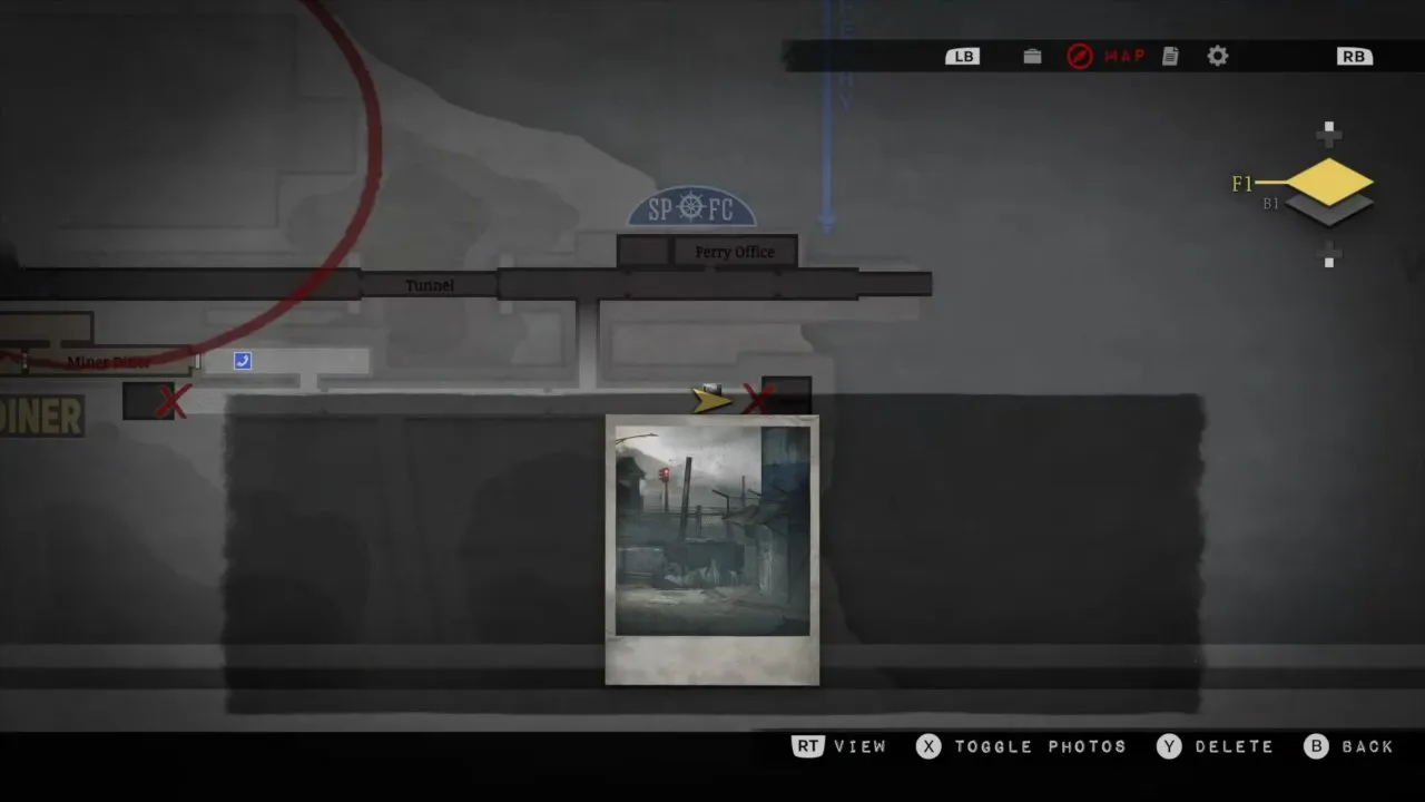
On the controller controls shown in the video:
- Press left or right on the D-pad to select the Polaroid, then press down to use it.
- Adjust the zoom and press RT to capture the picture.
- Open the map to check the attached photo. The screenshot shows the photo displayed over its map location, which is how you can confirm it was added.
You don't need film, so photograph anything that looks important instead of trying to remember its exact position. You can delete an unwanted photo with Y. This is useful when a location needs another visit: the picture gives you a visual reminder of what caught your eye.
Once you've collected the maps, you have the area layouts to refer to as you continue exploring. If you're working through the final locations, head to silver pines mount siah kopa for the mountain and finale route.